>Dams
The energy crisis has focused attention on hydroelectric dams in the Columbia River Gorge, yet these facilities provide not only a major power source but also flood control and navigation
The Columbia River Gorge’s big dams—especially Bonneville, The Dalles, and John Day—are part of a larger “ladder” of federal projects on the lower Columbia that reshaped the river in the 20th century. Built in an era when the Columbia was seen as both a powerful natural force and an economic engine, these dams were designed to harness the river’s flow for reliable electricity, make the river safer and more predictable for commercial navigation, and support regional growth with added benefits like irrigation supply, recreation, and water-quality management.
Historically, the Gorge was a challenging stretch of river—fast water, seasonal extremes, and major natural barriers to upstream travel. Bonneville Lock & Dam, completed in 1938, was the first federal lock-and-dam project in the Columbia–Snake hydropower/navigation system and marked a turning point: it paired hydropower generation with a navigation lock to help move boats and barges through the Gorge. Over time it was expanded with a second powerhouse (1982) and a larger navigation lock (1993) as regional power demand and river commerce evolved.
In the post-war decades, the river was further “stepped” with The Dalles Dam (constructed 1952–1957) and John Day Dam (completed 1971). These projects were authorized and operated as multi-purpose dams, supporting a mix of hydropower, navigation, flood-risk management, fish and wildlife needs, recreation, and irrigation—with reservoirs like Lake Celilo and Lake Umatilla created behind them.
From the beginning, fish passage was a major engineering concern—especially for salmon and steelhead. Large-scale systems like fish ladders were built to help adults migrate upstream, and modern operations often include measures such as seasonal spill to improve juvenile fish survival on their journey to the ocean.
At the same time, the dams’ benefits came with real costs. Reservoirs inundated places that had been culturally and economically vital for Indigenous communities, and damming has played a significant role in long-term ecological change in the basin—especially for salmon. Many discussions about the Gorge today try to hold both truths at once: the dams remain central to the Northwest’s power and river-transport system, while the region continues to wrestle with their environmental and cultural impacts.
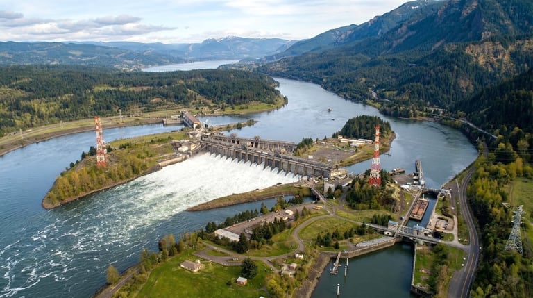
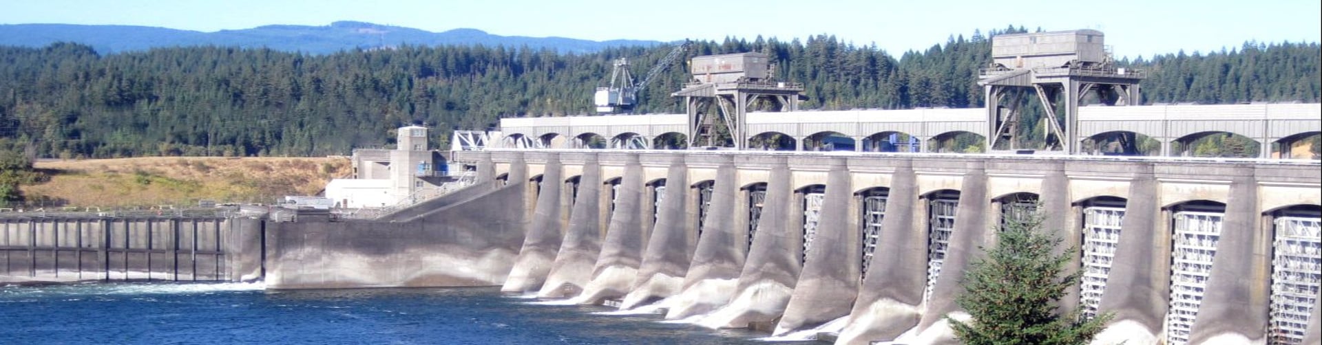
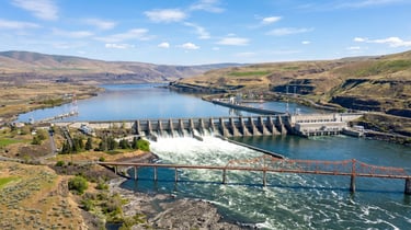
Bonneville Lock & Dam_
Cascade Locks, OR
541-374-8820
A national historic landmark, Bonneville was the first dam on the Columbia River; it was completed under the Roosevelt administration in 1937, and allowed ocean-going vessels to navigate upriver by inundating the treacherous Cascade rapids.
Nearby attractions include the Fort Cascades Historic Site and Trail on the Washington side downstream from the #1a1a1adam, Bonneville Fish Hatchery on the Oregon side at Exit 40, fishing areas, boat ramps, hiking trails, and overnight RV parking on the Washington side (no hookups). Bonneville Dam impounds Lake Bonneville, a 48-mile reservoir.
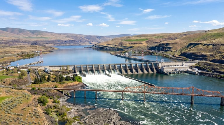
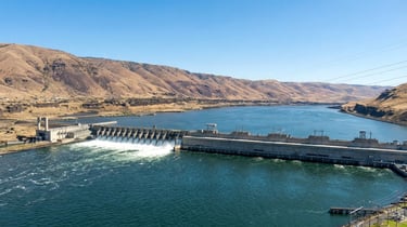
The Dalles Lock & Dam_
The Dallas, OR
541-296-1181
Completed in 1957, this is the largest US Army Corps project on the Columbia. The dam is located 192 miles upstream from the mouth of the Columbia River, two miles east of the City of The Dalles.
The powerhouse is nearly half a mile long, with 22 generators for a total capacity of 1.8 million kilowatts - enough electricity to supply two cities the size of Portland. There are two fish ladders, fish viewing, a display of Native American petroglyphs salvaged prior to the dam's completion, a navigation lock, and a tour train.
Another nearby attraction, separate from the dam but an integral part of the BPA distribution system, is the Celilo Converter Station just south of The Dalles off Highway 197. This facility converts alternating current from Columbia River dams to direct current for long distance transmission to California. The Dalles Dam impounds Lake Celilo, a 24-mile-long reservoir. To reach the visitor center, take Exit 87 from Interstate 84 and head north on Highway 197, or head south on Hwy. 197 from Wash. Hwy. 14.

John Day Dam_
Rufus, OR
541-296-1181
John Day Dam is located 25 miles upstream from The Dalles, crossing the Columbia near Rufus, OR, just below the mouth of the John Day River.
When completed in 1971, the dam contained the second-largest powerhouse in the world; with additional generators, the dam has the potential of producing 2.7 million kilowatts of power. Current capacity is 2.2 million kilowatts, enough to supply two cities the size of Seattle. A primary function of this dam is also flood control. Its reservoir, Lake Umatilla, can be lowered to provide capacity for half a million acre-feet of water during periods of high runoff. Lake Umatilla extends 76 miles east of John Day, to the base of McNary Dam.
Facilities include Giles French Park, fish viewing room and visitors' gallery on the Oregon side of the river. Access to the dam is from Interstate 84 at Exit 109.
Copyright Ticklecreek Design - All Rights Reserved
Contact | Disclaimer