
A world-class landscape that extends more than 100 miles east of Portland, where the Columbia River carves a dramatic canyon between the states of Oregon and Washington
The Columbia River Gorge
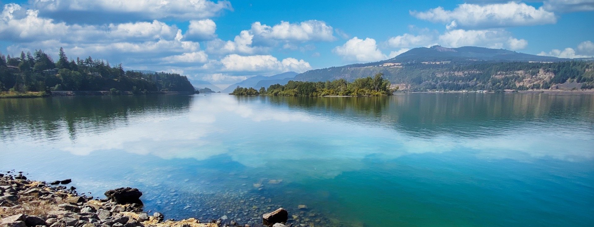
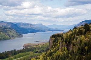
Stretching 80 miles through the Cascade Mountain Range, the Columbia River Gorge stands as the largest national scenic area in the United States—a landscape of dramatic contrasts where temperate rainforest gradually gives way to high desert, where sea-level river passages exist within sight of alpine meadows, and where ancient geology meets modern communities in one of the Pacific Northwest's most treasured regions.
A Landscape of Contrasts
The western entrance to the Gorge near Portland receives upwards of 75 inches of rainfall annually, nurturing dense forests of Douglas fir, western red cedar, and bigleaf maple draped in mosses and ferns. Travel just 80 miles east to The Dalles, and annual precipitation drops to barely 15 inches, supporting an entirely different ecosystem of oak woodlands, grasslands, and sagebrush. This dramatic transition—visible over the course of a single drive—occurs because the Gorge serves as the only sea-level passage through the Cascade Range, funneling moist Pacific air inland until it finally dissipates against the dry Columbia Plateau. Few places on Earth offer such a compressed view of ecological diversity.
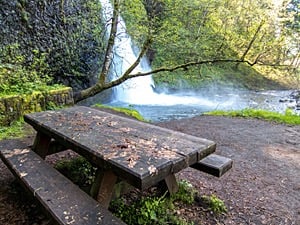
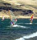
The Gorge's towering basalt cliffs, some rising more than 4,000 feet above the river, create a dramatic vertical dimension as well. A network of hiking trails climbs from lowland forests through wildflower meadows to windswept ridges on both the Oregon and Washington sides, offering everything from gentle riverside strolls to challenging all-day ascents. The river itself has earned international recognition for world-class windsurfing and kiteboarding, with reliable afternoon winds funneling through the narrow canyon drawing enthusiasts from around the globe. And the nearby snowcapped peaks of Mt. Hood and Mt. Adams extend the recreational possibilities even further, offering downhill and cross-country skiing well into late spring.
A Living Community
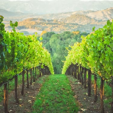
Yet the Columbia River Gorge is far more than a scenic backdrop—it is home to more than 70,000 people who have created a rich and vibrant regional culture. Small towns like Hood River, The Dalles, Cascade Locks, Stevenson, and White Salmon offer historic downtowns, farm-to-table restaurants, craft breweries, and thriving arts communities. The region has emerged as one of Oregon and Washington's premier wine destinations, with dozens of wineries and tasting rooms taking advantage of the unique microclimates created by the Gorge's geography. Orchards producing cherries, pears, apples, and peaches blanket the hillsides, while lavender farms and u-pick berry operations invite visitors to experience the agricultural heritage firsthand.
Historical museums and interpretive centers tell the story of the region's past and present. Art galleries showcase local and regional talent. Live theatre, music festivals, and community events fill the calendar year-round. The Gorge has become a destination not just for outdoor recreation, but for those seeking a slower pace, a creative community, and a deep connection to place.
Balancing Preservation and Progress
When Congress established the Columbia River Gorge National Scenic Area in 1986, it set forth two complementary goals: protecting the natural, cultural, and scenic resources of the Gorge while simultaneously supporting the economic vitality of its communities. This dual mandate—preservation alongside enhancement—was groundbreaking at the time and remains a guiding principle today.
The legislation created a unique management structure involving federal, state, tribal, and local partners working together to balance development pressures against conservation priorities. Urban areas within the scenic area boundaries are allowed to grow and develop, while surrounding rural and natural lands receive stronger protections. The result has been a landscape where working farms, small towns, and protected wilderness coexist—a model studied by land managers around the world.
Layers of History
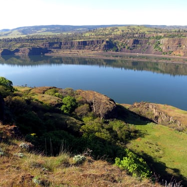
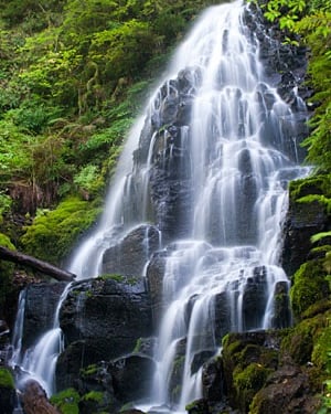
The Columbia River Gorge is also a place where history runs deep, its layers visible in the landscape itself. The geologic story began millions of years ago when massive flows of basalt lava, some of the largest volcanic events in Earth's history, spread across the region and eventually formed the dramatic cliffs that define the Gorge today. Much more recently—just 15,000 years ago—the landscape was catastrophically reshaped by the Missoula Floods, a series of ice age deluges that rank among the largest floods ever documented. When an ice dam repeatedly failed in present-day Montana, walls of water up to a thousand feet high roared through the Gorge, scouring the canyon to bedrock and leaving behind the waterfalls, alcoves, and dramatic rock formations visitors marvel at today.
Long before European exploration, Native American peoples made the Columbia River Gorge their home, establishing communities along its banks for at least 10,000 years. The river served as a vital travel corridor and trading hub, with Celilo Falls—before its inundation by The Dalles Dam in 1957—functioning as one of the oldest continuously inhabited sites in North America and one of the most important fishing and trading centers on the continent. Tribal nations including the Yakama, Warm Springs, Umatilla, and Nez Perce maintain deep cultural and spiritual connections to the Gorge to this day.
The Lewis and Clark Expedition traveled down the Columbia River in 1805, documenting the landscape and its people for an eager nation. Oregon Trail pioneers followed in the decades after, facing the treacherous river passage as the final obstacle before reaching the fertile Willamette Valley. Later came the sternwheelers and railroads that opened the interior to commerce, followed by the hydroelectric dams and aluminum plants that powered the region's 20th-century industrial growth.
Discover the Story
All of this history and more is explored in depth at the region's interpretive centers. The Columbia Gorge Discovery Center in The Dalles offers comprehensive exhibits on natural history, geology, Native American heritage, and pioneer settlement. The Columbia Gorge Interpretive Center in Stevenson, Washington, tells the story from the north side of the river, with particular focus on the Gorge's industrial heritage and the communities that grew up around the river. Smaller historical museums in towns throughout the region preserve local stories, from the salmon canneries of the lower Gorge to the fruit-packing operations of Hood River Valley.
Whether you come for the hiking, the waterfalls, the wine, or simply the views, the Columbia River Gorge rewards those who take the time to look deeper. Beneath the stunning scenery lies a complex and fascinating story—of geology and climate, of cultures ancient and modern, of preservation and progress—that makes this landscape one of the most compelling in the American West.


Copyright Ticklecreek Design - All Rights Reserved
Contact | Disclaimer