Sports_
Winter and summer recreation go together in the Columbia River Gorge like yin and yang. Each has its season, with just enough time in between to change equipment: from skis to sailboards, from snowboards to mountain bikes
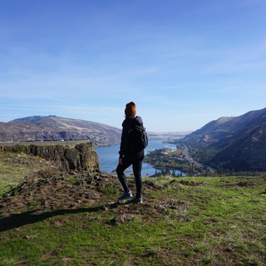
Sports in the Columbia River Gorge are shaped by the landscape itself: a steep river corridor that concentrates wind, stacks cliffs and ridgelines, and keeps water, trails, and high viewpoints close together. The Gorge is especially well known for wind-driven sports like windsurfing and kiteboarding, where steady breezes and wide launch areas create ideal conditions. On land, hiking and trail running are popular thanks to the region’s dense trail network and dramatic scenery, while cyclists are drawn to scenic routes and paved paths that follow the river and historic road corridors. The area’s volcanic cliffs also support rock climbing at several established crags, and nearby tributary rivers add a strong whitewater and paddling scene. Taken together, the Gorge offers a rare mix of water sports, endurance trails, climbing, and cycling in one compact region, with conditions that change seasonally and keep the recreation calendar active most of the year.
Cooler Weather
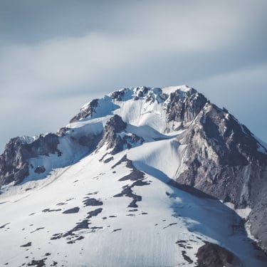
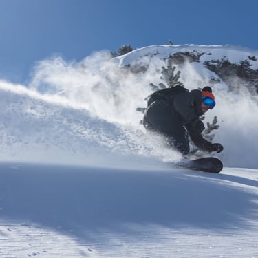
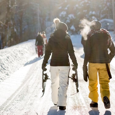
Skiing, Snowboarding & Snowshoeing on Mt. Hood
Mt. Hood is home to some of the Pacific Northwest’s best winter recreation, with resorts and lodges that cater to everyone from first-time skiers to seasoned riders. Whether you’re looking for historic charm, family-friendly slopes, or big-mountain terrain, there’s something for every type of adventurer.
Warmer Weather
Windsurfing
Few places in the world rival the Columbia River Gorge for windsurfing. Each spring, when the strong seasonal winds begin to sweep through the canyon, brightly colored sails dot the water like moving kites. Riders skim, jump, and carve across the river, taking advantage of one of the most consistent and powerful natural wind tunnels in North America.
The Gorge’s legendary winds are created by the clash of climates. Cool, moist air from the west meets the dry, hot air of the eastern deserts, creating a powerful pressure difference. This funnels Pacific air through the Cascade Mountains, producing steady winds that can last from March into late summer. By afternoon, those winds often grow stronger, providing ideal conditions for experts — while mornings can be calmer, perfect for learners.
The river itself adds to the appeal. Wide channels, protected coves, and rolling swells offer something for everyone — from beginners taking their first lesson to seasoned pros chasing big air.
Tips for Visitors
Check Conditions Before You Go
Wind strength can vary dramatically by site. Local hotlines like Bart’s Best Bet (541-386-3300) and K105’s wind line (541-386-1336 ext. 3) provide daily updates.Skill Levels Matter
Beginners should stick to protected areas like Hood River’s Marina or The Hook, while advanced riders head for Swell City, The Hatchery, or Doug’s Beach.Watch & Learn
Even if you don’t ride, many sites are fantastic for watching windsurfers in action, especially on summer afternoons when the Gorge is alive with sails.
The Gorge is lined with windsurfing launch sites on both the Oregon and Washington sides of the river. Here are some of the most popular spots.
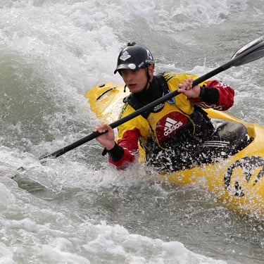
Whitewater Adventures on the White Salmon River
Few experiences match the thrill of paddling the White Salmon River in the Columbia Gorge. One moment you’re plunging through frothy rapids with icy spray on your face, the next you’re gliding into a calm emerald pool, surrounded by mossy rocks, ferns, and towering evergreens. Each bend brings a new set of challenges — drops to ride, eddies to maneuver, and lines to plot as the current pushes you downstream.
The White Salmon is one of the National Wild & Scenic Rivers of the Gorge, and while it may be short, it packs plenty of action. From the popular put-in near BZ Corners to the take-out at Northwestern Lake, paddlers encounter a steady mix of rapids ranging from Class I to Class IV, making it an exciting run for both guided rafting trips and skilled kayakers.
The river begins on the slopes of Mt. Adams, its cold, glacial waters rushing south through wildflower meadows, dense forests, and narrow basalt canyons before meeting the Columbia River at Underwood, Washington. Along the way are a series of named rapids such as Corkscrew and Stepping Stairs, which test even confident paddlers. For the most adventurous, Husum Falls — a Class V drop at certain water levels — is a legendary challenge.
What to Know Before You Go
Gear
The White Salmon runs cold year-round. Wetsuits, booties, and helmets are strongly recommended. At the very least, bring dry clothes or socks for the ride home.Season
Outfitters run trips much of the year, though spring and early summer bring the strongest flows.Access
To reach BZ Corners, drive east along Highway 14 on the Washington side of the Gorge, then head north on Highway 141 through White Salmon. The launch is about 20 minutes from town.Skill Levels
While sections of the river are suitable for intermediates, the upper stretches and Husum Falls are best left to advanced paddlers or those going with professional guides.
Other Rivers to Explore
The Gorge is rich with paddling opportunities beyond the White Salmon. The Klickitat River offers a wild ride through canyons and oak woodlands, while Oregon’s Deschutes River is a classic destination for rafting, fishing, and camping. The John Day River, one of the longest free-flowing rivers in the West, provides multi-day floats through high desert country.
Plan Your Trip
Whether you’re looking for a guided rafting trip or planning a kayaking run, local chambers of commerce can help connect you with outfitters and resources:
Mt. Adams Chamber of Commerce
509-493-3630Maupin Chamber of Commerce
541-395-2599
Ride the Rapids
With its combination of steady whitewater, lush scenery, and easy access, the White Salmon is one of the premier rivers for paddling in the Pacific Northwest. From the family-friendly stretches near BZ Corners to the adrenaline rush of Husum Falls, it delivers the perfect mix of challenge and beauty - a true Gorge adventure.
Cycling the Historic Columbia River Highway State Trail
For cyclists, the Columbia River Gorge is one of the most spectacular rides in the Pacific Northwest. The Historic Columbia River Highway State Trail offers a rare opportunity: to pedal along dramatic cliffs, through historic tunnels, and past waterfalls — all on a paved, car-free trail that retraces Oregon’s first scenic highway.
A Road Built for Scenery
When the original highway opened in the 1910s, it was celebrated as the “King of Roads.” Engineer Samuel Lancaster designed it to showcase the Gorge, with sweeping curves, stone viaducts, and tunnels that framed unforgettable views of the Columbia River.
While the construction of I-84 cut off much of the old road, Oregon has been gradually bringing it back to life — this time as a dedicated bike and pedestrian trail. Today, cyclists can ride several disconnected segments totaling more than a dozen miles, with more sections under active construction.
Mitchell Point Tunnel (The Star of the Show)
The biggest news for riders is the new Mitchell Point Tunnel, which opened in spring 2025. Modeled after the original 1915 tunnel — famous for its five arched windows — the new tunnel offers a dramatic, car-free experience and a direct link in the Gorge trail network.
Length
1.5 miles, paved and wide enough for comfortable cycling.Highlights
Scenic arched windows with river views, stone masonry walls, and a plaza with picnic tables for mid-ride breaks.Access
Connects with the Wyeth-to-Mitchell Point segment; a temporary path covers the last 0.7-mile gap until full construction is complete.
For cyclists, the tunnel is more than just a passage — it’s a historic ride reborn, and one of the most photogenic stretches of trail in Oregon. Here a few of the must-ride sections.
Bonneville Segment (Cascade Locks area)
Smooth pavement, gentle grades, and plenty of waterfalls make this stretch a classic. Perfect for families or casual cyclists. Trailheads at Toothrock, Eagle Creek, and Cascade Locks provide multiple ride options.Wyeth to Mitchell Point
Nearly 6 miles of riding past waterfalls and over the Summit Creek Viaduct — a stone bridge that seems to float above the Gorge. Now capped by the Mitchell Point Tunnel, it’s becoming one of the trail’s signature rides.Mosier Twin Tunnels
A favorite for road cyclists: 4.5 miles of river views, interpretive signs, and the cool shade of two restored tunnels. The steady grades make it accessible, while the views make it unforgettable.
Each section is fully paved, well-maintained, and closed to cars — meaning your biggest challenge will be deciding how many photo stops to make.
Ride Planning Tips
Best Bikes
Road bikes, gravel bikes, hybrids, and e-bikes all work well. Tires 28mm or wider are ideal for comfort.Access & Parking
Each segment has trailheads with parking, restrooms, and water. Wyeth, Viento, and Mosier are excellent starting points.Difficulty
Most sections feature gentle grades (2–4%), making them approachable for all levels.Season
Spring brings waterfalls and wildflowers, summer offers warm dry riding, and fall colors light up the Gorge. Early mornings or weekdays mean fewer crowds.Connections
For long-distance cyclists, the trail links into portions of Historic Highway 30 still open to cars — but with far lighter traffic than I-84. Combining road and trail sections makes for big-mileage Gorge adventures.
The Road Ahead
With just a few gaps left to close, Oregon is steadily working toward a fully connected 73-mile car-free corridor through the Gorge. Future projects east of Mitchell Point will link the trail toward Hood River, giving cyclists even more continuous riding. When finished, riders will be able to pedal from Troutdale to The Dalles on a route that blends history, scenery, and adventure like no other in the country.
Mountain Biking
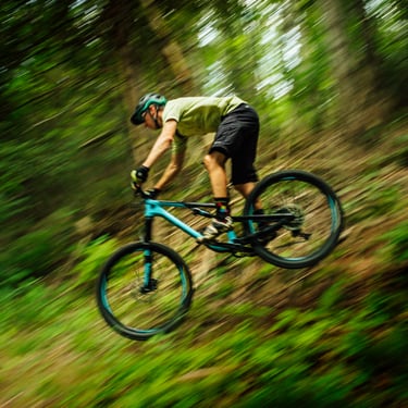
The Columbia River Gorge isn’t just for hikers and paddlers — it’s also home to some of the Northwest’s most scenic mountain biking. From high alpine ridges with views of Mt. Hood to canyon rides above the Klickitat River, there’s a trail for every style of rider.
Plan Your Ride
Skill Levels
Options range from family-friendly paved paths to steep backcountry routes.Seasons
Spring and fall offer cooler riding, while summer is best at higher elevations like Surveyor’s Ridge.Scenery
Expect a mix of alpine ridges, river canyons, oak woodlands, and desert terrain — no two rides are alike.
Whether you’re after a gentle spin with big views or a challenging downhill plunge, the Gorge delivers. With its variety of terrain and trails on both sides of the river, mountain biking here is as diverse as the landscape itself.
